
Hydrographic Survey Software: Advancing Precision in Marine Mapping
Explore hydrographic survey software: technology, applications, market trends, benefits, challenges, and future outlook in marine mapping and underwater data...

Introduction
In an era where accurate marine data drives critical decisions in navigation, construction, and environmental management, hydrographic survey software has emerged as an indispensable tool. This sophisticated technology transforms raw underwater data into actionable insights, enabling industries to map and analyze seafloor conditions with unprecedented precision.
Understanding hydrographic survey software is essential not only for marine scientists and engineers but also for stakeholders across shipping, offshore energy, and coastal infrastructure sectors. In this article, we will explore the core concepts of hydrographic survey software, delve into its practical applications, examine market trends, highlight key benefits, and discuss challenges alongside future outlooks.
Technology/Concept Overview
Hydrographic survey software refers to specialized applications designed to process, visualize, and analyze data collected from underwater surveys. These surveys typically involve instruments such as multibeam echo sounders, side-scan sonars, and single-beam echo sounders, which measure water depth, seabed morphology, and underwater features.
The software integrates raw data with geographic information systems (GIS) to create detailed bathymetric maps—digital representations of the seafloor. Key functionalities include data cleaning, noise filtering, sound velocity corrections, and 3D modeling. This makes hydrographic survey software a vital bridge between complex sensor outputs and user-friendly, interpretable maps.
Modern solutions often include real-time data acquisition, automated quality control, and compatibility with international standards such as the International Hydrographic Organization (IHO) S-44 standard, ensuring data accuracy and reliability.
Industry Applications & Use Cases
Hydrographic survey software is widely adopted across multiple sectors. In maritime navigation, it ensures safe passage by identifying underwater hazards and updating nautical charts. For instance, the U.S. National Oceanic and Atmospheric Administration (NOAA) employs these tools to maintain up-to-date navigational charts for commercial and recreational vessels.
In offshore oil and gas exploration, companies leverage hydrographic survey software to plan drilling sites and lay pipelines, reducing environmental risks and enhancing operational efficiency. A notable example is Royal Dutch Shell’s use of advanced hydrographic mapping for the Prelude FLNG project, enabling precise seabed assessments in remote offshore locations.
Coastal engineering projects, such as harbor expansions and beach nourishment, rely heavily on accurate seabed data. In environmental monitoring, hydrographic data supports habitat mapping and erosion studies, crucial for sustainable marine resource management.
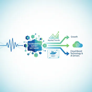
Market Trends & Growth Drivers
The global hydrographic survey software market is poised for robust growth, driven by increasing demand for detailed marine spatial data. According to a recent report by MarketsandMarkets, the hydrographic market is expected to grow at a CAGR of approximately 6.5% through 2028.
Key growth factors include rising offshore infrastructure projects, expanding maritime trade, and heightened emphasis on marine environmental conservation. Additionally, advancements in autonomous underwater vehicles (AUVs) and remotely operated vehicles (ROVs) equipped with sophisticated sensors are generating vast datasets, necessitating powerful hydrographic survey software for analysis.
Cloud computing and AI integration are also influencing the market, enabling real-time data processing and predictive analytics. These trends are making hydrographic surveys faster, more accurate, and cost-effective.
Market Trends & Growth Drivers
Benefits & Advantages
Adopting hydrographic survey software offers significant advantages. For businesses, it streamlines data processing workflows, reducing project timelines and operational costs. Enhanced data accuracy minimizes risks associated with marine construction or navigation hazards.
From a competitive standpoint, companies employing cutting-edge hydrographic software gain improved decision-making capabilities and regulatory compliance, particularly in regions with stringent maritime safety standards.
Return on investment (ROI) is often realized through fewer survey repetitions, optimized resource allocation, and improved environmental stewardship. For example, precise mapping helps avoid costly damage to underwater assets or ecosystems, safeguarding both finances and reputation.
Challenges & Future Outlook
Despite the clear benefits, hydrographic survey software faces challenges including high initial investment costs, the need for specialized training, and complex data integration from heterogeneous sources. Moreover, underwater environments pose technical difficulties such as signal interference and variable water conditions that can affect data quality.
Future innovations are focusing on enhancing user experience, incorporating machine learning algorithms to automate anomaly detection, and improving interoperability between hardware and software platforms.
Looking ahead, the fusion of hydrographic survey software with digital twin technology—virtual replicas of physical marine environments—is expected to revolutionize maritime planning and risk assessment. As the industry embraces these advancements, hydrographic survey software will become even more integral to sustainable ocean management and marine infrastructure development.
Conclusion
In summary, hydrographic survey software plays a pivotal role in unlocking the mysteries beneath our oceans by transforming complex raw data into actionable maps and insights. Its applications span navigation safety, offshore energy, coastal engineering, and environmental conservation, underscoring its broad relevance.
As market drivers like technological innovation and growing marine activities accelerate demand, organizations that invest in advanced hydrographic software stand to benefit significantly in accuracy, efficiency, and compliance. Overcoming existing challenges through innovation will further enhance software capabilities and market penetration.
Ultimately, hydrographic survey software is not just a technical tool but a strategic asset that empowers industries to navigate the future of marine exploration and stewardship with confidence.
Need More Details on Market Players and Competitors?
Tagged in